
Your trip, hour by hour, with walking and train times that actually add up.
Pick what you want to see and Routetto tells you what time you’ll reach each place: walking real streets, hills included, with the day’s train or ferry built into the plan. Move one thing and the rest of the day rearranges itself.
Start with the route.
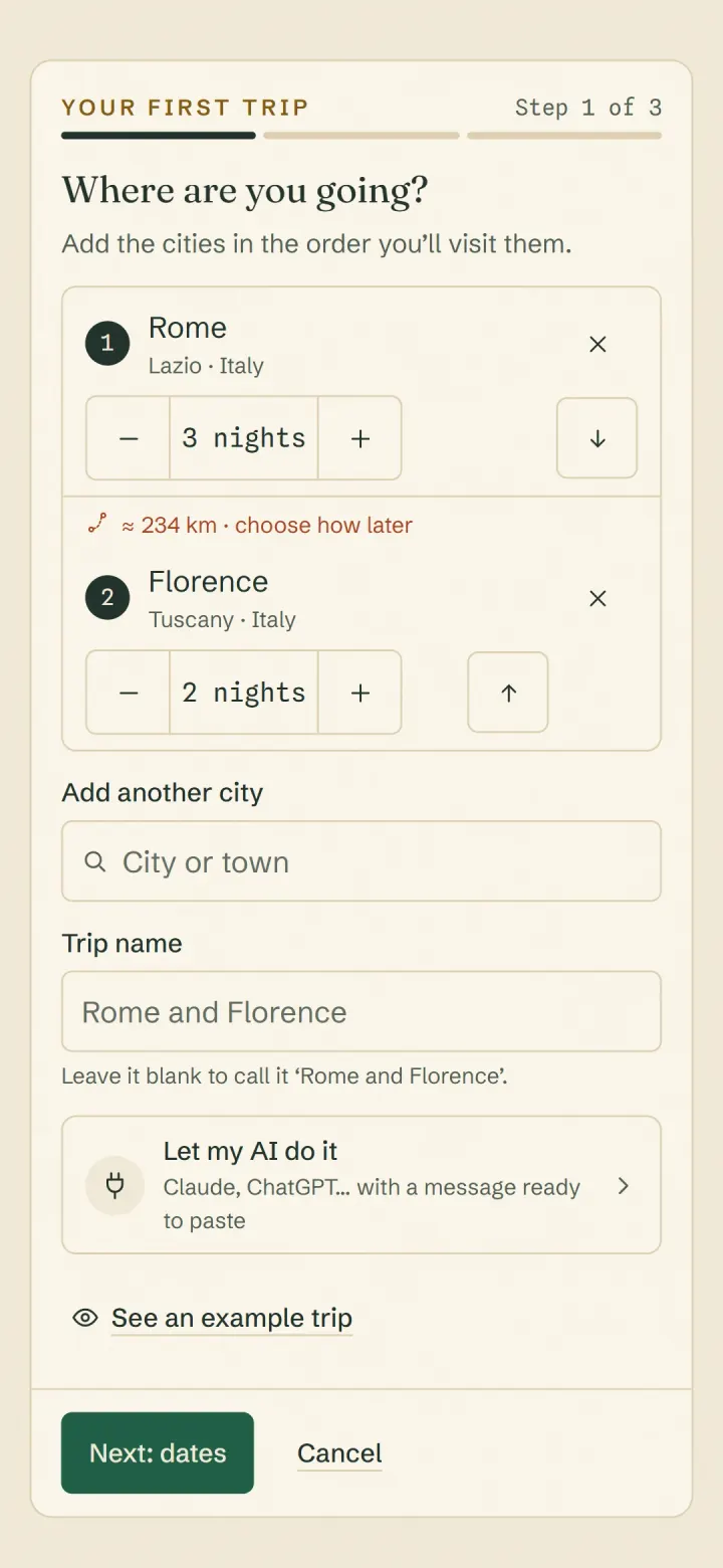
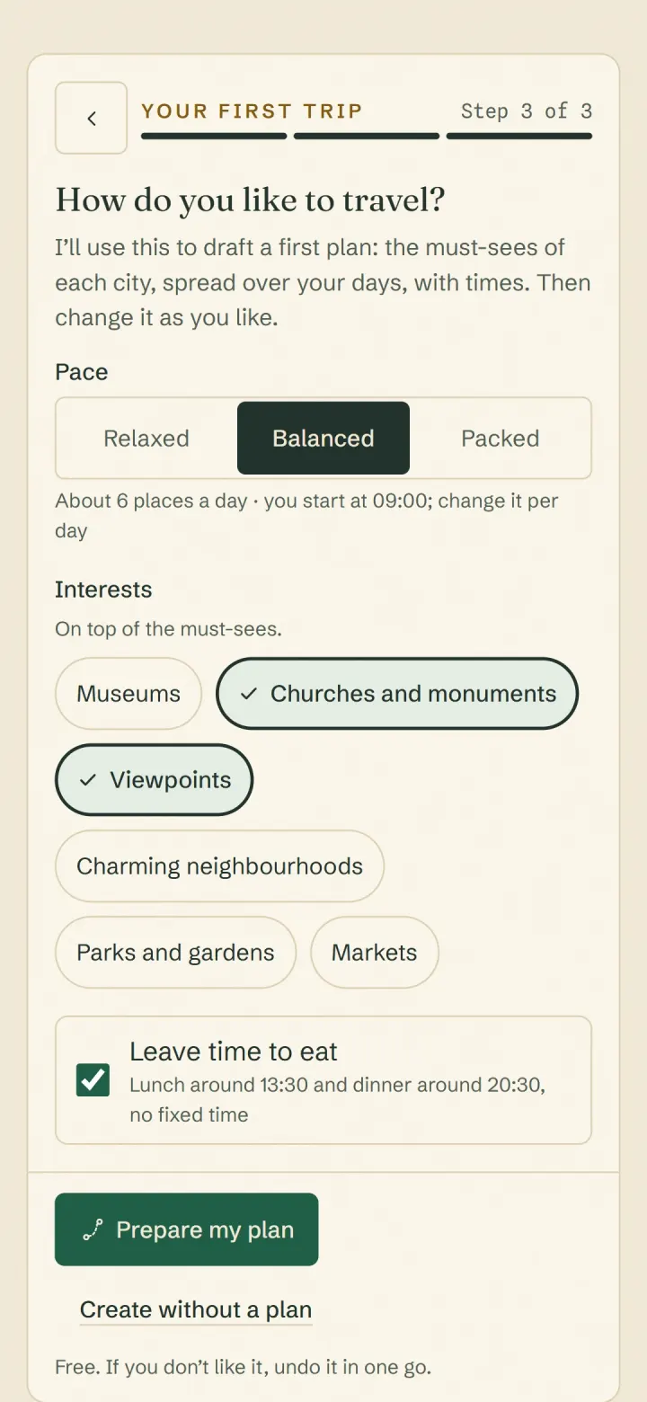
Type the cities in the order you’ll visit them, the nights you’ll spend in each and the day you arrive. Choose your pace and what you’re into. Routetto drafts a first plan with the must-sees of each city. It groups what’s close together into each day, orders it so you walk less and puts times on it. If you like, it leaves time for lunch and dinner.
It’s free and done in one step. Whatever doesn’t fit stays in Ideas, and if you don’t like the plan, you undo it in one go.
Or look at a finished one.
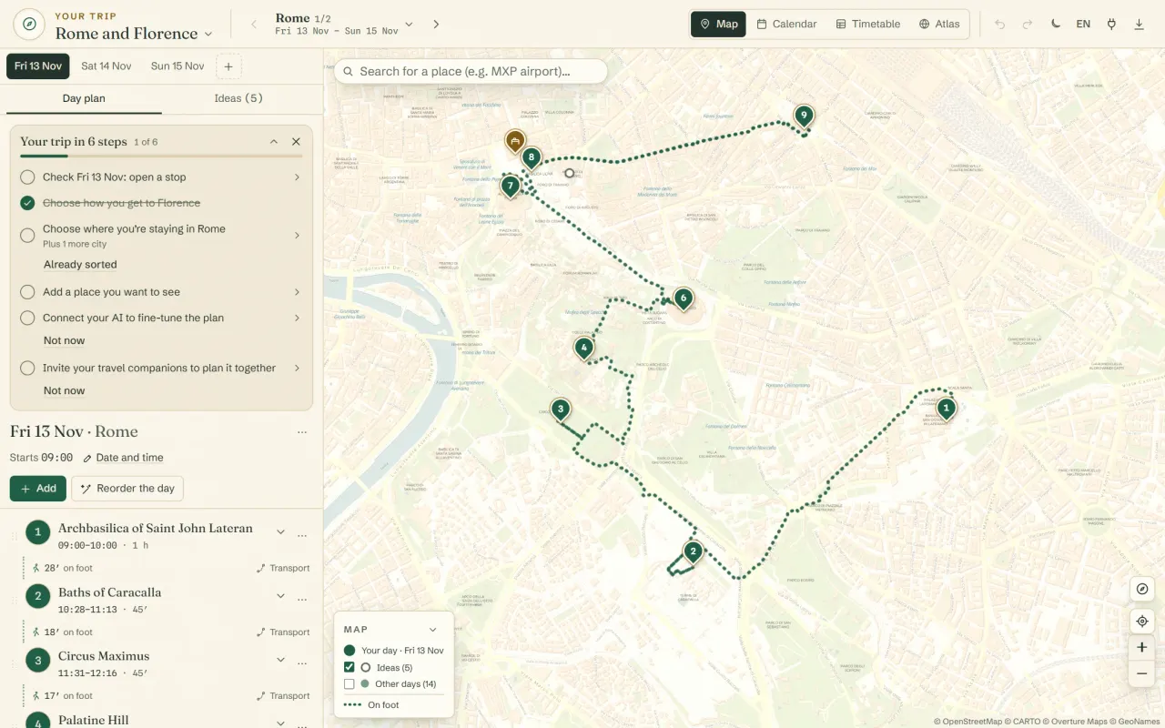
The first step of a new trip has ‘See an example trip’: Rome and Florence over six days, with its plan, its times and the drive from one city to the other. It’s view-only. If it suits you, ‘Make it mine’ copies it to your trips so you can change it.
An afternoon in Bergamo, start to finish.
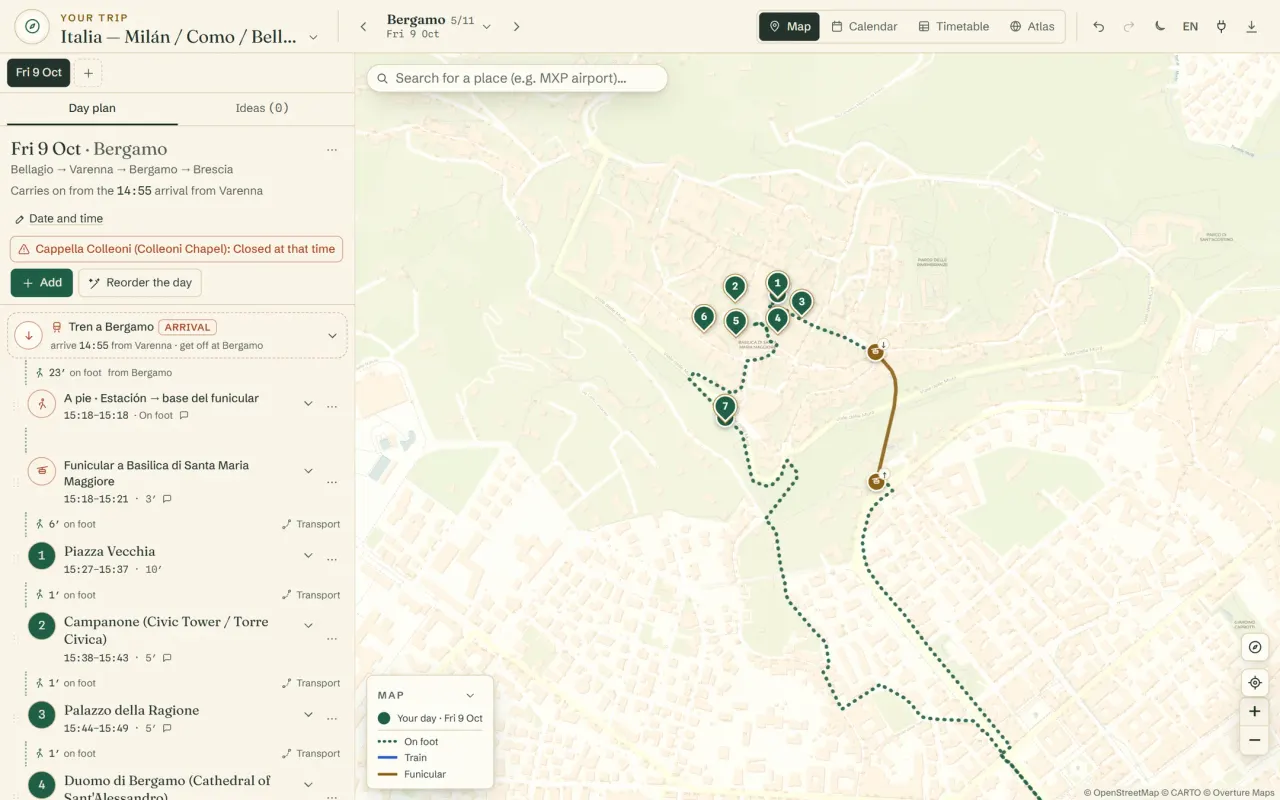
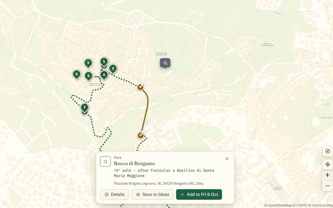
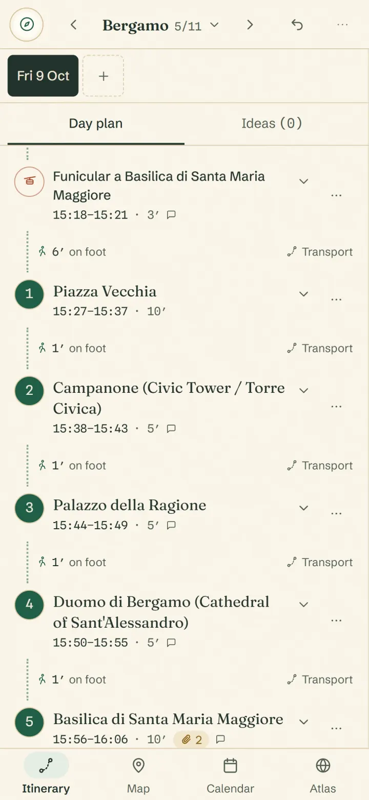
You arrive by train at 14:55, take the funicular up to the old town, see seven places and get back down in time for the 17:02 to Brescia. Every time comes from how long it really takes to get from one place to the next.
Move one thing and the afternoon rearranges itself.
Drag a visit to another slot and every time after it changes by itself. If that means you’ll miss your train, the train gets a warning: ‘You’ll be 11 min late’. Give a place its opening hours and the plan waits for it to open, and tells you if it’s closed when you arrive or closes before you’re done. Changed your mind? Undo.

Hills count too.
Bergamo’s upper town sits more than 100 metres above the lower one. A flat map says 15 minutes; your legs disagree. With credits, Routetto measures every leg on the actual streets and stairs and adds the climb; without them, it estimates in a straight line. If you take the funicular, your walk starts at the top, where it drops you.
It puts your visits in the order with the least walking. Add a new place and it tells you which two stops it fits between, and how many extra minutes you’ll walk.
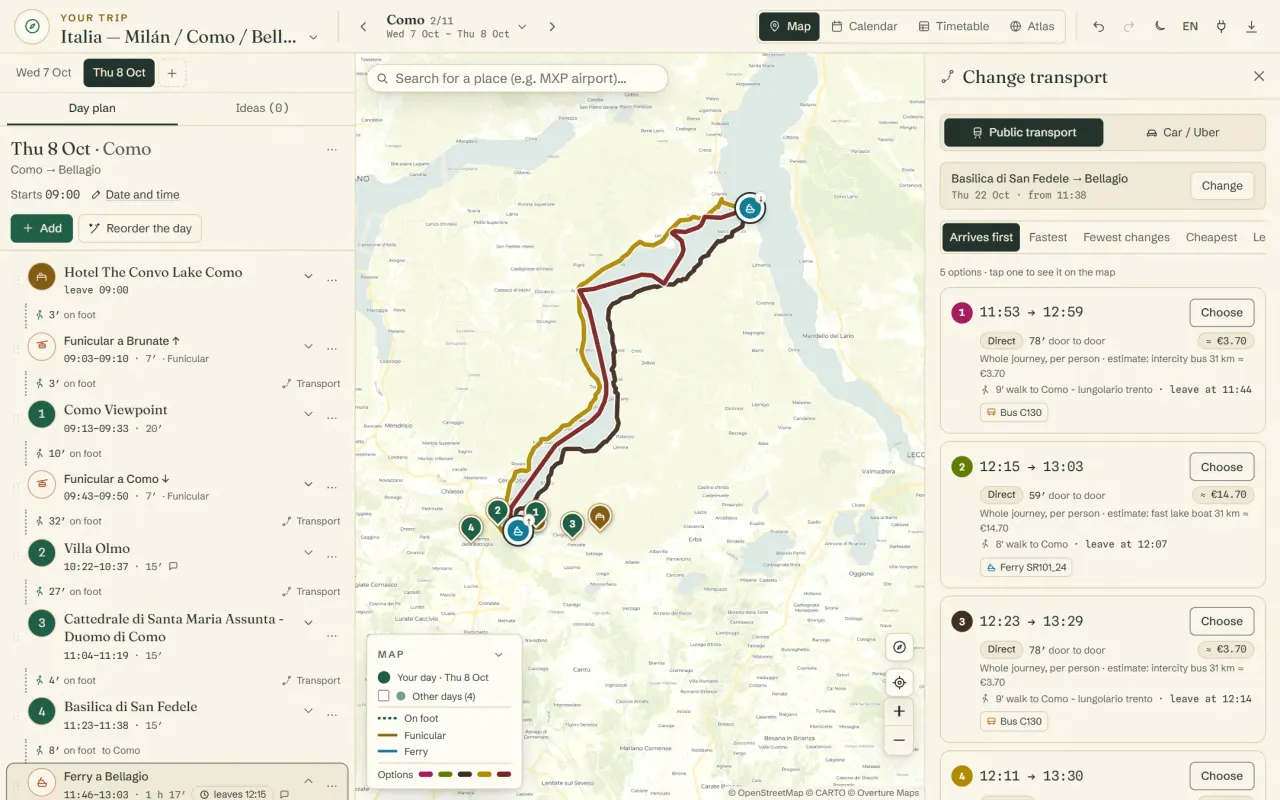
Trains and ferries, inside the day.
The Como–Bellagio ferry leaves from the pier, not your hotel, and the plan knows it: you walk to the pier, get on, and carry on walking from where it drops you. Choose between several options with the line, times, changes and fare per person, all drawn on the map.
If the fare isn’t published, we sometimes estimate it and label it as an estimate. If we can’t, we leave it blank. Transit times use credits. Prefer a car or an Uber? That’s free, with the journey time and a link to book the ride.
For whoever’s coming with you.
One plan, edited together.
Share the trip by email. Edit it together and see each other’s changes as they happen. Or share it view-only, with your mum, who wants to know where you’re sleeping. Once the trip has started, the phone opens on today.
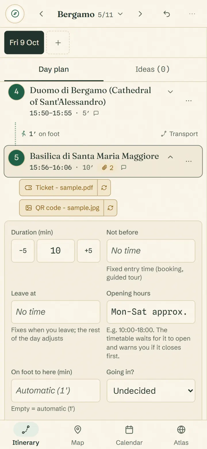
Tickets in your pocket.
Attach the PDF or a photo of the QR code to each stop. It’s saved on your phone and opens with no signal, in the queue for the Duomo or on a platform out of coverage.
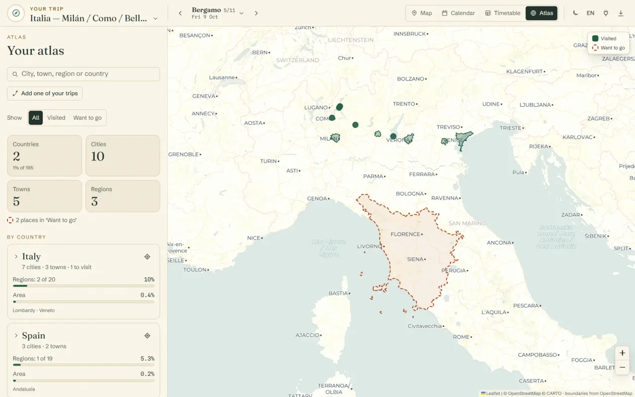
Atlas: where you’ve been and where you’re going next.
Colour in the towns, cities, regions and countries you’ve visited, in their real outlines, and the ones still on your list. It counts your countries and shows how much of each one you’ve actually set foot in. Add all the cities from a trip at once, and share the map with whoever you travel with.
With credits, the time you’ll really get there.
Planning is free, with no limit on trips. Without credits, Routetto estimates each walk as a straight line and gives you an approximate time. With credits, it measures it along the streets, stairs and hills, and puts the train, bus or ferry that actually runs into your itinerary.
The same afternoon, worked out both ways.
Bergamo, with 10 minutes on the walls. In a straight line, you reach the station at 16:59 and make the 17:02. Along the streets and stairs of the old town, you get there at 17:05, and the train is already flagged. You find out while you plan, not on the platform.
| Place | Straight linewithout credits | Streets and hillswith credits |
|---|---|---|
| Piazza Vecchia | 15:25 | 15:27 |
| Cappella Colleoni | 16:05 | 16:07 |
| Mura Veneziane | 16:23 | 16:29 |
| Bergamo station | 16:59 | 17:05 |
| Train to Brescia, 17:02 | On time | You’ll be 3 min late |
What credits get you
- Walks along the real streets and stairs, with every climb counted, and the time you’ll reach each place.
- Real public transport inside your itinerary: trains, buses and ferries with their times, changes and fares.
- Google photos and reviews of the places, so you know whether they’re worth the visit before you go.
- Restaurants near your route, with ratings and price level, and filters like ‘open now’.
- The day put in the order with the least walking, counting the hills and not just the distance.
- Your trip in Excel, with the times as formulas that recalculate, or in Google Sheets.
- Your connected AI does the same for you: it finds the train or reorders the day with the hills, and spends from your balance.
No subscription. Credits never expire. From €9.99, VAT included.
The €19.99 and €49.99 packs come with 10% and 20% extra credits. First purchase: 480 credits for €9.99, once per person and per card.
Free
€0
no limit on trips
-
€9.99
400 credits
-
€19.99
880 credits
+10% free
-
€49.99
2,400 credits
+20% free
Already planning with Claude or ChatGPT? Connect it to your trips: it can put the whole trip together and make its changes in the plan, not in a separate chat. How to connect it
Questions
How much does it cost?
Planning and sharing trips is free, with no limit, and so is the suggested plan, however often you redo it. A few things use prepaid credits, with no subscription: transit times, walking routes on the real streets and hills (and reordering the day with them), Google photos and reviews, rated restaurants and the Excel export. Without credits, walks are estimated in a straight line. Full details on the pricing page.
Does it work for any city?
Yes. Cities and towns come from all over the world, and the first plan looks for the must-sees in each one. We’ve used it most in Italy and Spain. If we know little about a small town, it says so and leaves the day free. Transit times depend on what each operator publishes, and some funiculars and local boats don’t show up.
Does it work offline?
Yes. The last trip you opened stays saved on your phone so you can check it without signal, along with any tickets and documents you’ve added. You’ll need a connection to change the plan or see the map.
Can I see it before I start?
Yes. In the first step, before creating anything, you can open an example trip, Rome and Florence, and look through it at your own pace. If it suits you, ‘Make it mine’ moves it into your trips so you can change it.
What languages is it in?
English and Spanish. You can switch inside the app whenever you like.
Is there a mobile app?
Routetto opens in your phone’s browser and you can add it to your home screen like an app. No app store needed.
Can I export it to Excel?
Yes, with the times as formulas, so they recalculate if you move a row. Also to Google Sheets, Google Maps and KML. Excel and Google Sheets use credits.
Your next trip, already in order.
Who makes it
Routetto is made by Bouzon Digital, a software studio in Benalmádena, Málaga. We built it to plan our own trip through northern Italy, and we’ve planned every trip since with it.
Servers in the European Union · Contact: info@routetto.com